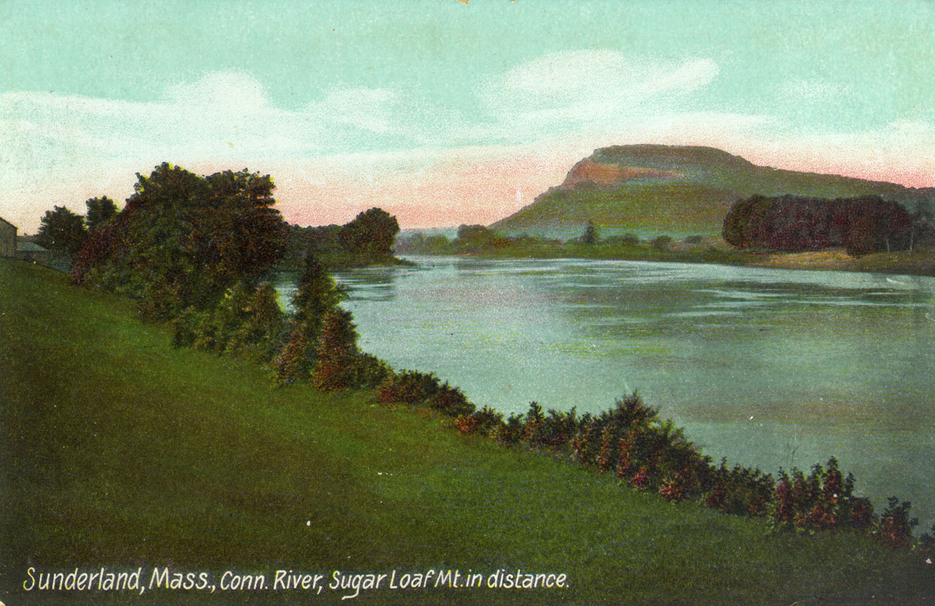
The Connecticut River flows 410 miles from New Hampshire’s northeast corner, along the Vermont-New Hampshire border, and through Western Massachusetts and the center of Connecticut before emptying into Long Island Sound near Old Saybrook, Connecticut. The river’s name comes from an Algonquian word meaning “long tidal river” (variously spelled Quonehtacut, Quinatucquet, or Quenticut by early English writers.) The river formed as the great ice sheet retreated during the last ice age, some 13,000 years ago. It followed a trench formed by a joint in the earth’s crust between the White Mountains in New Hampshire and the Green Mountains in Vermont. In Massachusetts, the river joined with the main line of Lake Hitchcock, a glacial lake that extended from central Connecticut into Massachusetts. The glacier’s retreat left a landscape of rocks torn from the mountains it passed, while the floor of Lake Hitchcock was made up of sand. The Connecticut River flooded these lands and deposited deep silt layers, particularly in Massachusetts and Connecticut. Generations of flooding formed some of the richest farmland in those states, with loam (rich topsoil) as deep as sixty feet in some places.
For hundreds of years, the valley was home to various Native American peoples, including the Pocumtucks, whose homeland was in the area now known as Deerfield, the Norwottucks in present-day Northampton and Hadley, the Sokokis near Northfield, the Agawams around Agawam, and the Woronocos near West Springfield. Most Indigenous peoples in the Connectucut River Valley were driven out by English settlers who arrived in the 17th century.
In 1636, William Pynchon, an English businessman, purchased land from the Agawam people and founded Springfield. His son John extended settlements northward, including Northampton, Westfield, and Hadley. By the 1670s, English settlements extended as far as Northfield, on the present Vermont-Massachusetts border. However, a series of wars, beginning with Metacom’s (King Philip’s) War (1675-76), made the valley a dangerous place to live and few chose to settle there until after the French and Indian War (1754-1763).
During the Industrial Revolution (1760-1840) mills and factories were estabished along the river, including woolen and paper mills, factories producing knives and cutlery, and armories in Springfield and Hartford.
Consequently, the river’s other uses, particularly what had been a vibrant fishing industry, badly degraded. By the turn of the 20th century the river was too polluted to sustain large stocks of fish, a situation that continued until the 1960s. Then several factors intervened to begin the river’s rehabilitation. During the massive deindustrialization of the United States in the late 1960s and 1970s many factories moved from their old plants along the Connecticut. And the environmental movement began looking at the country’s formerly pristine waterways and demanded change. In the 1970s the Clean Water Act began regulating the discharge of pollution, and the Connecticut’s water quality steadily improved. Since then the changes have been dramatic. The river has returned to health and its uses have changed with its quality. Formerly an industrial channel, the river has become a prime recreational area. Many Connecticut River Valley towns have changed their economies accordingly. The beauty of the Connecticut River and its valley, celebrated in the first decades of the 1800s and captured by painters such as Thomas Cole (in his famous “Ox-Bow” painting held at the Metropolitan Museum of New York), has come to be appreciated once again.