The Mohawk Trail (Massachusetts State Route 2) in Western Massachusetts was named after one of the Native American groups that used this route. Interest in automobile travel rose as assembly line manufacture and technological improvements made cars more affordable for ordinary Americans. Pictured here is an early automobile driving along the improved, but unpaved road in about 1915. The peak in the distance is Mt. Greylock. At 3,491 feet above sea level, it is the highest summit in Massachusetts.
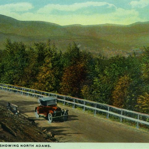
Curt Teich and Company, Incorporated, photographer. Western slope showing North Adams. Photograph. ca. 1915. Pocumtuck Valley Memorial Association, American Centuries. https://americancenturies.org/collection/1999-03-0038-01/. Accessed on April 3, 2026.
Please note: Citations are generated automatically from bibliographic data.