The Mohawk Trail (now Massachusetts State Route 2) runs from Greenfield over the Hoosac Tunnel to North Adams and Williamstown, and ends in Troy, New York. Its route roughly parallels a trading route that connected the Connecticut Valley Native Americans, particularly the Pocumtucks, with the Hudson Valley Native Americans including the Mahicans, whose lands bordered the Iroquois Five Nations Confederation that contained at its eastern end, the Mohawk nation. This cover mixes design motifs from a number of Indigenous ethnicities, few of which directly connect to the Mohawks. The trail was conceived as a scenic automobile route and tourist attraction in the early 1900s, and work on its infrastructure began as early as 1912. By 1921, the road had been entirely rebuilt and in the 1920s, tourists patronized the numerous hotels and resorts along its route. In the early 21st century, the trail is still a significant tourist destination, although less so than in the past.
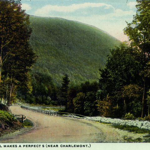

Curt Teich and Company, Incorporated, photographer. Souvenir Folder of Mohawk Trail, Mass. Photograph. ca. 1915. Pocumtuck Valley Memorial Association, American Centuries. https://americancenturies.org/collection/1999-03-0038-cv/. Accessed on March 31, 2026.
Please note: Citations are generated automatically from bibliographic data.