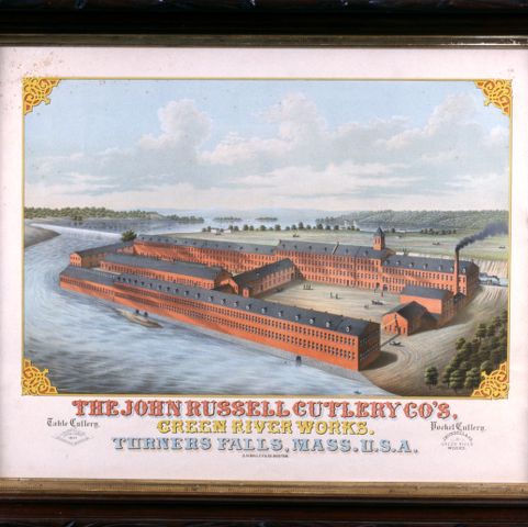
Turners Falls, Massachusetts, was a planned community. When this map was created, a handful of industries had moved to town and they needed a workforce. The purpose of this map was to entice workers, businesses they might frequent, and more factories to relocate there. Notice that although a grid of streets exists, most of the lots are empty. At a glance, anyone thinking of coming to work in a factory or open a business could see plenty of space laid out and available for development. In addition, the town’s site on the banks of the Connecticut River would be a valuable asset for more factories.

Oakley H. Bailey (1843-1947). Turners Falls, Mass. 1877. Pocumtuck Valley Memorial Association, American Centuries. https://americancenturies.org/collection/1999-13-502/. Accessed on April 3, 2026.
Please note: Citations are generated automatically from bibliographic data.