This map of Central and Western Massachusetts was included in Samuel Drake’s Old Indian Chronicles, published in 1867. The book is primarily composed of original accounts of King Philip’s (or Metacom’s) War (1675-1676), a devastating conflict between Indigenous peoples and European settlers. Although the map is supposed to show settlements at the time of the war, it includes boundaries for English towns that weren’t established until later. For example, Sunderland, shown opposite Deerfield, was not established until 1709.

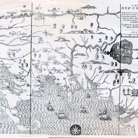
Drake, Samuel G. [Map of the Nipmuck or Nipmuck Country compiled from a 1774 Survey published in “The Old Indian Chronicle”.] Map/Plan. Samuel A. Drake, 1867. Pocumtuck Valley Memorial Association, American Centuries. https://americancenturies.org/collection/l07-026/. Accessed on March 11, 2026.
Please note: Citations are generated automatically from bibliographic data.