The First Turn, 1680-1720
Unit Central Questions
What do primary and secondary sources teach us about the characteristics of “everyday life” of individuals living in Deerfield at the three turns of the centuries?
What do these characteristics reveal about changes in the town since its beginning as an English settlement?
Key Content Ideas Taught in this Lesson and Teacher Background
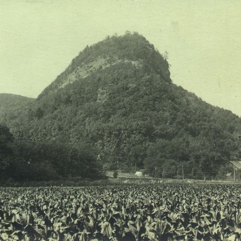
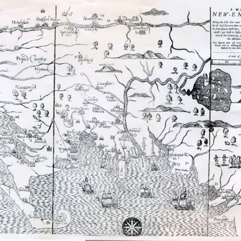
Deerfield was established by English settlers on land that lies in a river valley, west of the Connecticut River, including the Pocumtuck Range and the Deerfield River. It is located in the bed of glacial Lake Hitchcock, and includes fertile land and woodland areas.
For more information read:
Teacher Background Essay: Geology and Formation of New England
Intended Learning Outcomes
Understandings:
Students will understand:
- The topographical and geographical makeup of Deerfield.
- That the Massachusetts section of the Connecticut River Valley is located in the bed of glacial Lake Hitchcock, which contributes to its being a fertile valley.
Skills:
Students will be able to:
- Read and analyze topographical maps.
- Extract key information from articles.
In Preparation for Teaching
- Read key content ideas above and Geology and Formation of New England
- Review Richard Little excerpts
- Prepare maps and handouts. (U.S. Geological survey maps may be ordered online from the U.S.G.S. web site.)
Activities
Activity 1: Rading Topographical Maps (thirty minutes)
(note: this lesson may be done online using the zoom feature to explore the maps. If working online, have students work in pairs. There are several views for each map. The first page shows a map in its entirety and other pages show sections.)
- Divide students into groups of four.
- Distribute laminated topographical maps to each group.
- Instruct students to look at the information at the bottom of the whole map to find which part of Massachusetts it is showing.
- Make sure students understand how to use the various scales in the legend. You might ask them to try measuring a section of road.
- On the Mt. Toby map ask students what they think the wavy lines mean. When they are close together, such as on Mt. Toby, what does that mean? When they are further apart, such as in the area to the left of North Sugarloaf Mtn., what does that mean? (The wavy lines show the contour of the land. Where they are close together, the land rises steeply.)
- What does the green color represent? (areas with trees)
Activity 2: Geologic Time and Lake Hitchcock
(thirty minutes, plus extra time for step eight)
- Distribute copies of excerpted sections from Richard Little’s books.
- Call attention to timeline on cover. Note how short a time humans have been on earth. Have students use the model of the outstretched arms and the hand to get an idea of the extension of all the time on earth.
- Instruct students to read the second page of the packet introducing Lake Hitchcock, underlining important ideas and words that they need to know to understand what the page is about.
- Ask for clarification of (or ask students to look up) the following vocabulary:
- ice lobe – a section of ice from a glacier left from the Ice Age
- delta – a flat-topped, sandy-gravel land form built as a stream flows into a lake or an ocean
- glacier – an extended mass of ice
- glacial lake – a lake formed when a glacier melted
- permeable – capable of being penetrated
- erode – wear away through the forces of nature
- spillway – a passageway through which surplus water escapes from a reservoir or a lake
- Identify the spot on the map where Deerfield would eventually be.
- Examine the map of the Old Deerfield area on the next page of the packet, comparing it to the topographical maps used in first session, and clarifying words such as “flood plain.”
- Instruct students to summarize the information about geological time and about Lake Hitchcock in their individual notebooks.
- Form a committee of students to construct a geological timeline on long roll of paper.
Activity 3: A Drive Through Lake Hitchcock
(thirty minutes)
- Explain to students that they will be taking an imaginary drive through Lake Hitchcock. Instruct students to read the section of the packet, “Site 7: A Drive Through Lake Hitchcock,” underlining what they think are the most important parts.
- [Optional] Instruct students to find the elements described in the “Road Log” on their Map of Old Deerfield (see activity 2, above).
- Distribute Worksheet 1 (“Worksheet 1. Site 7: A Drive Through Lake Hitchcock”) after students finish reading.
- Discuss reading, using questions on the worksheet as guidelines, relating areas to the topographical map.
- Instruct students to summarize the information from this article in their individual notebooks, completing this for homework.
Activity 4: Mount Sugarloaf and a Drive From Mount Sugarloaf to Mount Toby via the Whately Dunes
(thirty minutes)
- Divide class into two sections.
- Instruct section 1 to read the part of the packet about Mount Sugarloaf and section 2 to read the part about a drive from Mount Sugarloaf to Mount Toby, underlining what they think are the most important parts.
- Distribute Worksheet 2 (“Site 5: Mount Sugarloaf”) to the first section, and Worksheet 3, (“Site 6: A Drive From Sugarloaf to Toby via the Whately Dunes”) to the second, instructing students to be prepared to summarize their reading by using the worksheets as a guide.
- Form a circle of students from section 1, with students from section 2 surrounding them to observe. Discuss the information in the article on Mount Sugarloaf with section 1, taking brief notes on the board.
- Reverse the sections in number 4, above, and discuss the information in the article on the drive from Sugarloaf to Toby with section 2, adding to the notes on the board.
- Assign students to write a summary of both sections in their notebooks, finishing for homework.
Assessment
Students’ summaries.