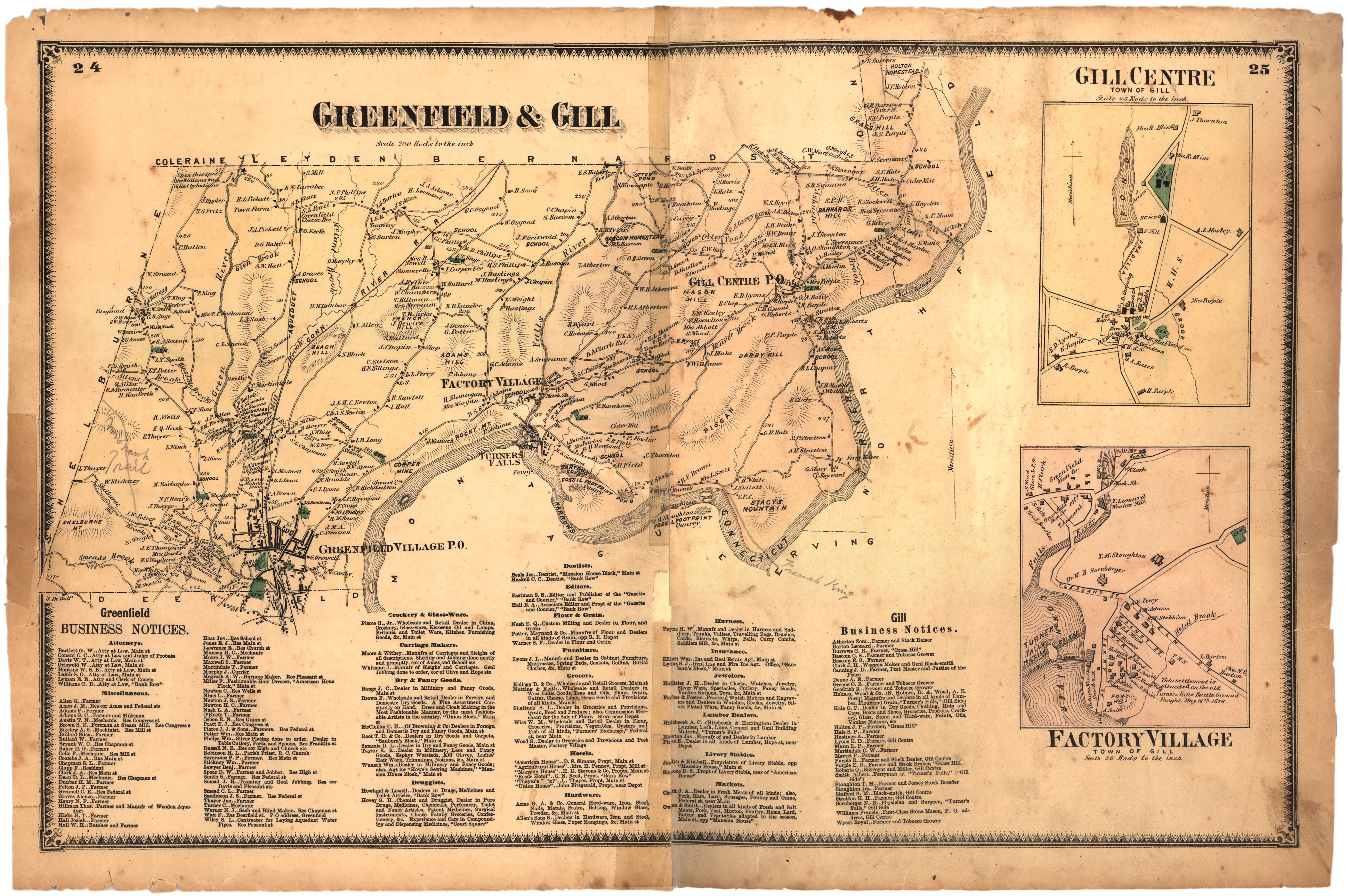
Gill was originally part of Deerfield, Massachusetts, and then became part of Greenfield before being incorporated as a separate town in 1793. It was named in honor of Lt. Gov. Moses Gill (1746-1799), who donated nails, glass, and a bible for the first meetinghouse. Gill is bordered by the Connecticut River on the south and east, lying in one of the river’s great bends. At one time, the river supplied such an abundance of salmon and shad that the fish came to be called “Gill-pork,” and people were often ashamed to be seen eating them. Gill’s residents and geology played significant roles in some of the region’s most notable political and natural history. In its southwest corner, Gill meets Greenfield and Montague’s village of Turners Falls at a falls in the river. This spot was once a gathering, fishing, and trading site for Native peoples, called Peskeompskut, and was the scene of a 1676 attack on a Native encampment by Captain William Turner (1623-1676) during Metacom’s (King Philip’s) War (1675-1676). During Shays’ Rebellion (1786-1787), two of the four men who were shot at the Springfield Armory were from Gill. In 1835 fossilized dinosaur tracks were reportedly discovered by Greenfield stonemason Dexter Marsh (1806-1853), in stone taken from a quarry in Gill at Barton Cove on the Connecticut River. Marsh reported his discovery to Dr. James Deane (1801-1858) of Greenfield, who contacted prominent geologist Edward Hitchcock (1793-1864) at Amherst College in nearby Amherst, Massachusetts. Today Gill is noted for the Northfield Mount Hermon School, a private college preparatory school in the town’s Mount Hermon section. It’s also home to Barton Cove Campground, a power company environmental stewardship facility and a prime location for river kayaking and for viewing bald eagles and other wildlife.