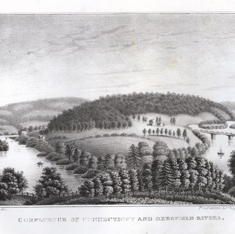
A photographer captured an early bird’s-eye view of Deerfield, Massachusetts, from the highest point of land, Pocumtuck Mountain. The village street, defined by the houses on either side, has been planted with shade trees, but the steeple of the meetinghouse rises above them. The Deerfield River, a liquid roadway, flows north along the western edge of the farm fields, to join the Connecticut River in Greenfield. Cultivated for nearly 2000 years, first by the Pocumtucks and later, in the 17th century, by the English, the cleared land extends east and west from the main street.
Bradford, Pelham, photographer. Deerfield Panorama. Photograph. Pocumtuck Valley Memorial Association, American Centuries. https://americancenturies.org/collection/1996-12-0443-01/. Accessed on April 3, 2026.
Please note: Citations are generated automatically from bibliographic data.