Canals, turnpikes, and railroads began transforming urban and rural landscapes in the 1800s. By the end of the 19th century, railroads and trolley lines connected outlying towns in the Connecticut River Valley of Massachusetts to a wider world. The transportation revolution extended beyond rail travel. Growing numbers of bicyclists and automobile enthusiasts lobbied for more and improved roadways. Rapid as these changes were, this bucolic view of a horse-drawn buggy traveling an unpaved road leading to Leyden, Massachusetts, is a reminder that changes in transportation technology and roadways did not occur overnight. The postcard provides other clues about the landscape in this area at the turn of the 20th century. The grass-filled lane suggests that this is a sparsely settled and less-traveled area. The trees growing down to the road and the abandoned fence reveal that land once cleared for farming has reforested, a phenomenon typical in many parts of New England at that time.
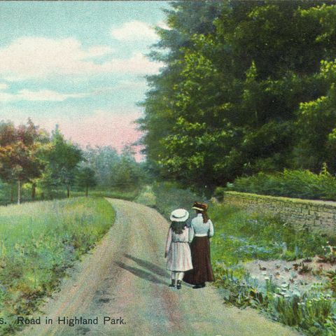
The Springfield News Company, photographer. Road to Leyden. Photograph. ca. 1900. Pocumtuck Valley Memorial Association, American Centuries. https://americancenturies.org/collection/1999-03-0013/. Accessed on April 3, 2026.
Please note: Citations are generated automatically from bibliographic data.