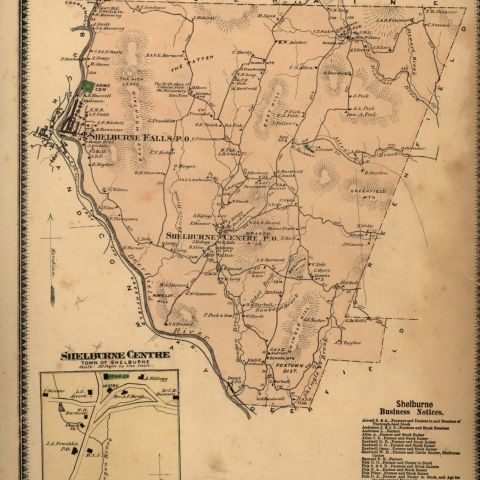
This topographical map shows Buckland, Shelburne Falls, Shelburne, and Conway, Massachusetts. Although not large, Shelburne Falls is the biggest town on the map. The terrain is hilly. Contour lines printed in brown include spot elevations and provide a visual impression of the shapes of hills and ridges. Each line indicates an increase in height of ten feet, and the spacing of the lines indicates the amount of slope. Those areas where contour lines appear close together represent steep slopes or precipices.
U. S. Geological Survey. Shelburne Falls, Mass. Map/Plan. 1961. Pocumtuck Valley Memorial Association, American Centuries. https://americancenturies.org/collection/l98-003/. Accessed on April 4, 2026.
Please note: Citations are generated automatically from bibliographic data.