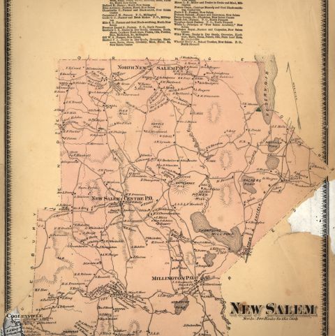
The Quabbin Reservoir straddles the border of Hampshire, Franklin, and Worcester counties of Massachusetts and was created by the razing and drowning of four towns: Dana, Greenwich, Enfield, and Prescott. Agriculture and small water-powered industry kept them alive through the early and mid-nineteenth century, but continued westward expansion and post Civil War industrialization caused a population decrease as young residents left for the city or the west. The accompanying economic decline was further accelerated by the Great Depression(1929-1939). When Boston, Massachusetts, began looking for additional water resources, these Swift River towns were a logical choice to all but local residents. With approximately 2,500 residents in the impacted areas, officials believed this was minimally disruptive in the larger scheme of the state.
Greene, J. R. An Atlas of the Quabbin Valley Past and Present. Transcript Press, 1983. Pocumtuck Valley Memorial Association, American Centuries. https://americancenturies.org/collection/l05-150/. Accessed on April 29, 2026.
Please note: Citations are generated automatically from bibliographic data.