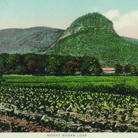
Below Mt. Sugarloaf, a farmer tends his crops. South Deerfield, Massachusetts’ position along the Connecticut River meant that the periodic floods deposited some of the richest soil in the northeast onto lands adjacent to its banks. Behind the farmer, tall poles stand for the summer’s snap bean crop as he tends to his strawberry beds. By the turn of the 20th century, reliable rail transportation meant that farmers were able to send crops to far-away markets that in previous years would have been entirely dependent on local produce. Behind him, the S&G Mill with its distinctive cupola stood ready to grind the fall’s harvest.
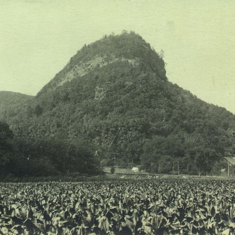
Forrest L. Stetson’s Electric Print, photographer. Mt. Sugarloaf with farmer. Photograph. 1910. Pocumtuck Valley Memorial Association, American Centuries. https://americancenturies.org/collection/1997-08-01-0081/. Accessed on March 28, 2026.
Please note: Citations are generated automatically from bibliographic data.