Kennebec Curve

From the collections of PVMA • Digital image © Pocumtuck Valley Memorial Assoc. • Image use information

About this item

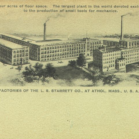
Athol, Massachusetts, is situated on the Millers River in northern Worcester County. This postcard shows a train from the Fitchburg division of the Boston and Maine Railroad navigating the Kennebec Curve on the river.

Related Items

Details

Item typePhotograph
Postcard
PhotographerUnidentified
Date1925–1935
PlaceAthol, Massachusetts
TopicTransportation, Travel, Tourism
Land, Environment, Geography
EraProgressive Era, World War I, 1900–1928
Great Depression and World War II, 1929–1945
MaterialPaper
Process/FormatPrinting
Dimension detailsHeight: 3.50 in Width: 5.37 in
Catalog #1997.08.01.131
View this item in our curatorial database →
Kennebec Curve. Photograph. Pocumtuck Valley Memorial Association, American Centuries. https://americancenturies.org/collection/1997-08-01-131/. Accessed on January 19, 2025.

Please note: Citations are generated automatically from bibliographic data.