“Sunderland and Leverett”

From the collections of PVMA • Digital image © Pocumtuck Valley Memorial Assoc. • Image use information

About this item

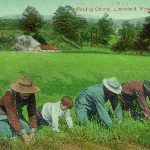
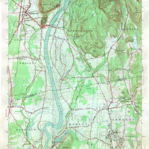
In this map, Sunderland, Massachusetts, clearly shows the original 1718 layout of homelots. They tended to be long and narrow, a design that can be seen in other Connecticut River Valley towns such as Deerfield and Longmeadow, Massachusetts. In comparison, the homelots in Leverett, established in 1750, do not follow this pattern.

Related Items

Details

Item typeMaps, Plans, Blueprints
AuthorBeers, Frederick W.
PublisherF. W. Beers and Company
Date1871
PlaceSunderland, Massachusetts; Leverett, Massachusetts
TopicLand, Environment, Geography
Commerce, Business, Trade, Consumerism
Architecture, Buildings
EraCivil War and Reconstruction, 1861–1877
MaterialPaper
Process/FormatPrinting; Lithograph; Watercolor
Dimension detailsProcess Material: lithograph, paper, ink, watercolor Height: 15.50 in Width: 24.00 in
Catalog #L02.018
View this item in our curatorial database →
Beers, Frederick W. Sunderland and Leverett. Map/Plan. F. W. Beers and Company, 1871. Pocumtuck Valley Memorial Association, American Centuries. https://americancenturies.org/collection/l02-018/. Accessed on October 16, 2024.

Please note: Citations are generated automatically from bibliographic data as a convenience, and may not be complete or accurate.