Williamsburgh, Massachusetts

From the collections of PVMA • Digital image © Pocumtuck Valley Memorial Assoc. • Image use information

About this item

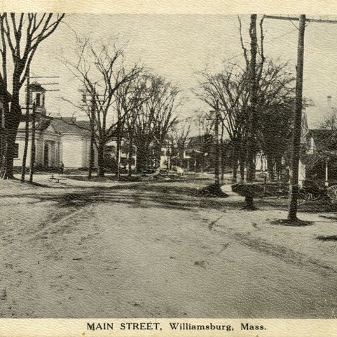
Williamsburg, Massachusetts, was incorporated in 1775. It  was once home to a silk mill, a brass works, and a shop that made ivory buttons. The town is composed of two villages- Haydenville and Williamsburg. This map was published in 1873, before a tragic dam failure in 1874 (known as the Mill River Flood) devastated the town.

Related Items

Details

Item typeMaps, Plans, Blueprints
AuthorBeers, Frederick W.
PublisherF. W. Beers and Company
Date1873
PlaceWilliamsburg, Massachusetts
TopicLand, Environment, Geography
Media, Periodicals, Communication
EraCivil War and Reconstruction, 1861–1877
MaterialPaper
Process/FormatPrinting; Lithograph; Watercolor; Ink
Dimension detailsProcess Material: lithograph, paper, ink, watercolor Height: 14.00 in Width: 12.00 in
Catalog #L09.009
View this item in our curatorial database →
Beers, Frederick W. Williamsburgh, Massachusetts. Map/Plan. F. W. Beers and Company, 1873. Pocumtuck Valley Memorial Association, American Centuries. https://americancenturies.org/collection/l09-009/. Accessed on October 16, 2024.

Please note: Citations are generated automatically from bibliographic data as a convenience, and may not be complete or accurate.